Crispin’s
Guide to Stirling Cycling – Weekend Tours
Killin Weekend Routes
Background:
Heading to Killin for a weekend break is one of my
favourite trips. A choice of scenic
routes can be combined with reasonably priced accommodation in Killin Youth Hostel.
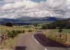
OPTION 1
Via Loch Earn (About 50
miles from Stirling)
Via Loch Earn
|
Stirling to Braco
via Sherrifmuir
Route – Stirling - Bridge of Allan – Sherrifmuir – Greenloaning – Braco
Notes: A massive climb to 850-ft over Sherrifmuir and Cauldhame (Multimap link) 12
miles.
via Dunblane.
Head out of Stirling to Bridge of Allan. Cycling through Kippenrait Glen (Multimap link) allows you to avoid the main road between
Bridge of Allan and Dunblane. This
route is liable to subsidence and has been fenced off but can be ridden with
care and offers some dramatic scenery.
To pick up Kippenrait Glen, head through Bridge of Allan into Allanwater. Just before the bridge over the river, take
a right at the mini-roundabout and start climbing. Keep left every time the road forks, making sure you do not track
into the housing estate. You will then
reach a series of signs stating that the road is closed - ignore these and keep going past
Drumdruills to Badgergate. Drop into
Dunblane and turn right at the roundabout, heading for Kinbuck and Braco (Multimap link).
12 miles
Comrie Moor (Multimap link)
Head out of Braco on the
A822 for a short distance and then turn left on the B827 towards Comrie. Immediately after this junction, an old
Roman camp is on your right and is worth a look. This is an excellent road across open moor land which then drops
into Dalginross and Comrie. It’s now
about lunchtime and there are plenty of places to eat in Comrie. My favourite is the Comrie Coffee House, on
the corner as you leave the village to the west.
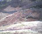
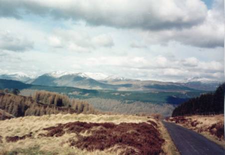
The descent from Comrie Moor
to Dalginross
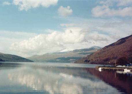
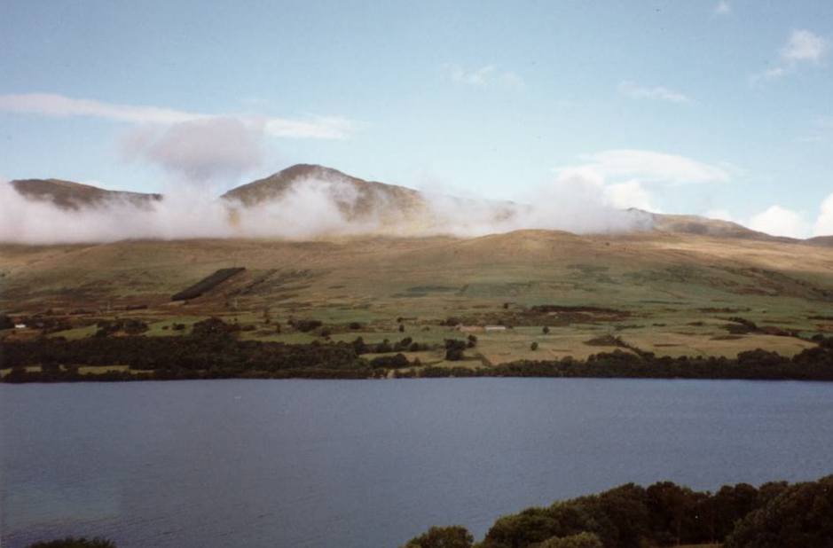
Loch Earn (Multimap link)
From Comrie, leave on the
A85 to the west, signposted Lochearnhead and Loch Earn. To minimise exposure to traffic, turn left
over the humpback bridge and then right, to take you on a minor road.
Rejoin the A85 and then at
St Fillans, at the east end of Loch Earn, you have a choice of route.
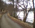
The south side of Loch Earn
is a superbly quiet, humpy road. The
north side is flat but with some fast moving traffic. Go south ! The loch is
about 14 miles long and the distance from Comrie to Lochearnhead is 19 miles.
An excellent café is
situated half a mile from Lochearnhead on the north side of the loch. (Loch-side cafe & Watersports Centre,
Lochearnhead (Tel: 01567 830 330). Open
Easter – September, weekends in October.
Glen
Ogle
The route from Lochearnhead
to Killin is known as Glen Ogle. The
National Cycle Network Route 7 (Sustrans) route is off-road and involves a
steep climb from Lochearnhead to the railway viaduct. It is then a flat ride with stunning views to Glen Ogle
head. On road, the A84 can be a
dangerously busy road, especially in summer.
To pick up the off-road
route, turn off the A84/A85 at the sign for the Scottish Episcopal Church. This is between the north- and south
lochside roads. Climb up and up. Before crossing the bridge, the track is
down on your left - head north for Glen Ogle & Killin. I have written elsewhere about the route to Balquiddher and Callander.
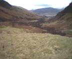
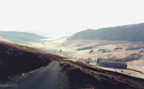
Looking back from the top of Glen Ogle
A snack bar is in
residence at the top of Glen Ogle (altitude about 950ft). Stop for a cup of tea.
It’s all down hill
from here. You can descend on the cycle
route to Killin – this used to be surfaced with loose gravel but I have had
heard reports that this has been improved.
Alternatively, descend on-road to Lix Toll and then turn right to
Killin.
OPTION 2
Via Balquiddher and
Callander (About 45 miles).
Via Loch Earn
|
The route here
decribes the ride from Killin to Stirling , because I am too lazy to retype
it. I think it rides better this way
because there are lots of gentle downhill sections besides the River Teith into
Callander. I am not sure why the
mileages do not add up, but hey ho!
Killin -
Callander.
Route - Killin – Lix Toll –
Glen Ogle - Lochearnhead (Multimap link)-
Balquhidder – Callander
Distance: 30.5 miles,
Climbing: 1660 ft, time: 3 h 11 minutes
Most of this route is
off-road – following the Sustrans route to Callander. The climb out of Killin is on loose gravel. We chose to climb on the main road from Lix
Toll. In summer this is a busy road: be
careful. At the top of the pass, pick
up the cycle route (it is off to your right – with a barrier and Sustrans marker
thing at the entrance) and continue to Lochearnhead – a gem of a route with
superb views. Continue on this track
all the way to Balquhidder (stop to look at Rob Roy’s grave in the church yard),
where you follow up minor roads to Strathyre and then back on the track to
Callander. The final section is a bit
rougher, but otherwise everyone coped on their touring bikes with no problems.
Food: lots of choices !
Glen Ogle head. The top of the pass. During the summer a burger van is in residence. Highly recommended.
Lochearnhead –Loch-side cafe & Watersports Centre, Lochearnhead (Tel: 01567 830 330). Open Easter – September, weekends in October.
After dropping down the zigs
on the cycle track you pass under a railway bridge. A rough track comes in your left. Follow this track back up for 100yds to a tarmac’d lane and
descend in Lochearnhead. Turn left and
then right to pick up the road along the north shore of the loch. The café is on your right. Excellent bacon butties !
To regain the cycle track in
Lochearnhead, turn off the A85 at the sign for the Scottish Episcopal
Church. Climb up and up. Before crossing the bridge, the track is
down on your left.
Balquhidder – The Old Library. Lunches and Teas.
Strathyre – tea shops
Callander – lots of choices. I like the small tea-shop next to the bridge
to the B8032 (by the traffic lights). Do
not forget to call in at Wheels of Callander/ Trossachs
Backpackers (Tel: 01887 331200) just outside of Callander (on the minor
road to the south of Loch Venacher) – to say “Hi” and to scrounge a cup of tea.
Callander to Stirling
Callander – Doune – Bridge
of Allan – Stirling (& home!) (Multimap link)
Distance: 20 miles,
Climbing: 350 ft, time: 1 h 55 minutes
Out of Callander, follow the
minor road along the River Teith
(B8032) to Doune. Turn left over the
bridge, turn right into Doune and continue through the village. After leaving the village, turn right
following signs for Dunblane. Then take
another right onto a minor road to Inverardoch Mains that brings you out in
Bridge of Allan. On entering Stirling,
stop at Corrierrie’s café for coffee.
OPTION 3
Via Glen Quaich, Sma Glen and Loch Tay (About 70 miles)
Cycle to Braco, as described for Option 1,
and then onto Muthill and Crieff (about25 miles) (Multimap
link).
In Crieff, the Visitors Centre with restaurant is on your left as
you enter town. Clean and not too
expensive. Climb through Crieff and
pick up the A85 to the east and then the A822 to the north (signposted
Aberfeldy). Another option, to avoid
the A85, is the lovely ride through Glen Turret and its distillery (multimap
link).
The A822 is not a busy road and descends through Sma Glen before
climbing to Amulree (Multimap link). The
road to Glen Quaich is shortly before the village of Amulree. Here there is a
coffee-shop that is sometimes open (ie only when you have just eaten) and a
hotel. Crieff to Amulree is about 12 miles and from Amulree to Kenmore about
10 miles.
Glen Quaich – to the north and to the south
Glen Quaich wanders
past Loch Freuchie, before a very steep climb with superb views from the top on
a clear day.
The descent to Kenmore
is extremely steep with a 376m (1200ft) drop –TAKE CARE.
Ensure that your
parachute is deployed and that you have adjusted your flameproof underwear before
starting this descent. In addition,
there are cattle-grids and gates on both sides of this pass. Be warned, the cattle grids get very greasy
in the wet and have been known to bite.
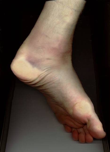
Bruising on my ankle
after I fell down a cattle-grid on Glen Quaich
Heading through Glen
Quaich to Amulree involves a brutal climb out of Kenmore, but has the advantage
that the descent to Loch Freuchie is less likely to result in your brake-blocks
bursting into flames.
For more information on some of my rides through Glen Quaich – see
these StirlingCycling webpages: Perthshire Ramblings and Whiteknuckle Ride.
At Kenmore, there is a
sailing centre with café (100m on your left at the bottom of the descent). This is probably the best place to stop for
something to eat. There is a hotel in
Kenmore and one poor-quality, over-priced
tea-shop.
All you have to do now
is cycle the length of Loch Tay to Killin.
The south road is the one to use. - this is a hilly 17 mile ride with
superb views. There are no shops or
facilities on this section of the ride.
Via Loch Earn
|
© Crispin Bennett 2002
Crispin’s
Guide to Stirling Cycling – Weekend Tours