Crispin’s Guide to Stirling Cycling – Extended Tours
Scottish Highlands & Lowlands Tour - September 2001
Background:
This tour was ridden in
September 2001 by myself and five others.
The route takes in the central Scottish highlands and covers many scenic
lochs and glens on roads with minimal traffic.
It’s an absolute gem of a route.
If you wish to spend a week cycling in this area you should certainly
consider riding all, or at least some, of this route.
IMPORTANT NOTE: Both Perth
and Glen Doll Youth Hostels have now been closed.
Day 1 – Saturday
Stirling to Perth.
Route – Stirling - Bridge of
Allan – Sherrifmuir – Greenloaning (map #2)– Braco – Glen Eagle’s -
Auchterarder (Multimap link)(coffee, #3) – Dunning –
Perth SYHA Hostel (#4)
Distance: 37 miles,
Climbing: 2640 ft, time: 3 h 23 minutes
Notes: A massive climb to
start with over Sherrifmuir and Cauldhame
(Multimap link), but then just gentle
undulations all the way to Perth
The Tearoom , Auchterarder –
has a red and white canopy and is opposite the Co-Op. Highly recommended.
Day 2 – Sunday
Perth to Glen Doll.
Route – Perth – Almondbank -
Moneydie - Bankfoot (coffee) – Murthly
– (Avoid the A93 by using minor roads through Meikleour) - Blairgowrie – Alyth
(Multimap
link)(lunch) – Kirriemuir (shopping)– Clova (Multimap link)– Glen Doll SYHA Hostel (#5)
Distance: 65.6 miles,
Climbing: 4680 ft, time: 6 h 10 minutes
Notes:
Out of Alyth, follow signs
for Glenisla. Then pick up minor roads
parallel to the A926 to get to Kirriemuir.
Bankfoot coffee shop – next
to the local shop / garden centre.
Recommended.
Alyth – Nordic café. Recommended.
Get your shopping in
Kirriemuir as there are no food shops after this. The youth hostel at Glen Doll is 4 miles from the hotel at
Clova. The SYHA has announced that Glen
Doll youth hostel is up-for-sale - stay here while you can !
Clova hotel also has a bunk
house (so I’ve been told).
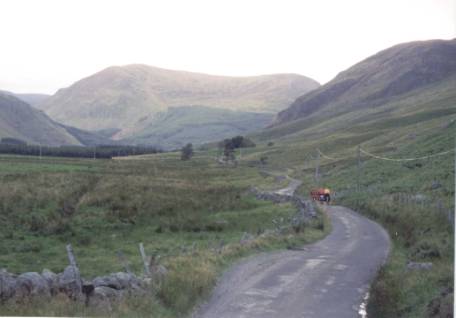
The road between Clova and
Glen Doll
Glen Doll
Day 3 – Monday
Glen Doll to Pitlochry.
Route: Glen Doll - Clova – Kirriemuir (coffee) – Glenisla (on the B951) – Bridge of Bewlands – Blacklunans
– Kirkmichael (on the B950) – Pitlochry (#6).
Distance: 59.1 miles,
Climbing: 3800 ft, time: 5 h 10 minutes
For lunch, we found a hotel
at Glenisla. The one on the south side
of the road is CTC-recommended.
There are also some hotels/
coffee shops on the A93.
In Pitlochry, the best coffee-stop
is found on the loch side by heading north out of town and then following signs
for fishing boat hire.
We stayed at the SYHA hostel
in Pitlochry. There is also an
Independent hostel in Pitlochry which has received good reviews.
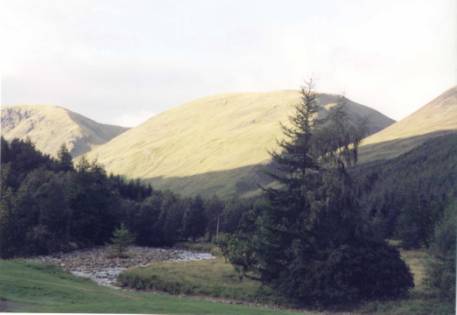
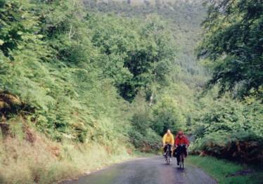
The road between Kirriemuir
and Glenisla
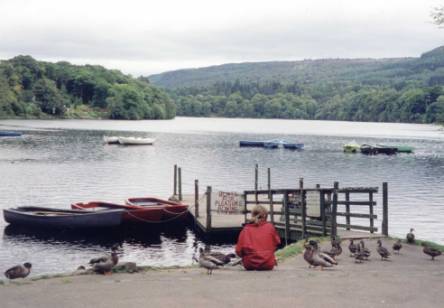
Feeding the ducks at
Pitlochry
Day 4 – Tuesday
Pitlochry – Kinloch Rannoch.
Route – Pitlochry – Tummel
Bridge (via south side of Loch Tummel) – Kinloch Rannoch (#9)– Rannoch Station
(Multimap link) (coffee, #8) – Kinloch
Rannoch
Distance: 59.4 miles,
Climbing: 3430 ft, time: 5 h 11 minutes
Notes: This can be an exposed ride. Shorter options include Pitlochry to Kinloch
Rannoch (20 miles). The out-and-back
ride to Rannoch Station from the Bridge of Gaur, west end of Loch Rannoch is a
total of 10 miles, so by missing this out gives a mileage for the day of 50
miles.
Buy food either in Pitlochry
or in the store in Kinloch Rannoch.
At Rannoch Station, the
Station Café is far friendlier than the hotel.
For accommodation, there is
not much choice so you may wish to book ahead.
We enjoyed staying with Jim Wilson at the Gardens, Dunalastair, 4 miles
from Kinloch Rannoch (Tel: 01882 632434).
Day 5 – Wednesday
Kinloch Rannoch - Killin.
Route – Kinloch Rannoch –
Inverhaden (over the shoulder of Schiehallion via the Braes of Foss) (Multimap link) – Coshieville –
Fortingall (coffee in the hotel) – Bridge of Balgie (coffee, #10) – Glen Lyon –
Loch Lyon - Killin (via Glen Lochay and a massive climb).
Distance: 54.5 miles, Climbing: 3790 ft, time: 5 h 12 minutes
On leaving Bridge of Balgie (Multimap link) carry on, ignoring
the dead-end signs. An alternative is
to leave Glen Lyon via Ben Laws visitor centre, but this is no shorter and
still involves a massive climb.
Continue on this single track road.
Eventually you will pass a small cluster of houses at Pubil. Follow the
road up to the left – this takes you up and over to Kenknock in Glen Lochay. This road is not shown on Multmap but does
exist, honest.
Notes: This is an exposed ride. Do not attempt western Glen Lyon unless you
are confident riding long distances on a bike.
An easier route to Killin from Fortingall is along Loch Tay. You can either ride along the north shore,
or preferably head across to Kenmore and ride the delightful (but not flat)
road along the south side of Loch Tay.
There are not many places to buy food for picnics - Kinloch Rannoch and
Killin are the only places we passed; the shop at Bridge of Balgie has a very
limited selection.
We stayed at the SYHA hostel
in Killin: comfortable and friendly.
For an evening meal we went to the Bridge of Lochay hotel – excellent.
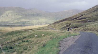
Cycling along Glen Lyon,
shortly after Fortingall
Climbing out of Glen Lyon
Day 6 – Thursday
Killin - Callander.
Route - Killin – Lix Toll –
Lochearnhead (Multimap link)- Balquhidder –
Callander
Distance: 30.5 miles,
Climbing: 1660 ft, time: 3 h 11 minutes
Most of today is off-road –
following the Sustrans route to Callander.
The climb out of Killin is on loose gravel. We chose to climb on the main road from Lix Toll. In summer this is a busy road: be
careful. At the top of the pass, pick
up the cycle route and continue to Lochearnhead – a gem of a route with superb
views. Continue on this track all the
way to Balquhidder, where you follow up a minor road to Strathyre and then back
on the track to Callander. The final
section is a bit rougher, but otherwise everyone coped on their touring bikes
with no problems.
Food: lots of choices !
Glen Ogle head. The
top of the pass. During the summer a
burger van is in residence. Highly
recommended.
Lochearnhead –Loch-side cafe & Watersports Centre,
Lochearnhead (Tel: 01567 830 330). Open
Easter – September, weekends in October.
After dropping down the zigs
on the cycle track you pass under a railway bridge. A rough track comes in your left. Follow this track back up for 100yds to a tarmac’d lane and
descend in Lochearnhead. Turn left and
then right to pick up the road along the north shore of the loch. The café is on your right. Excellent bacon butties !
To regain the cycle track in
Lochearnhead, turn off the A85 at the sign for the Scottish Episcopal
Church. Climb up and up. Before crossing the bridge, the track is
down on your left.
Balquhidder – The Old Library. Lunches and Teas.
Strathyre – tea shops
We stayed at Trossachs Backpackers (Tel: 01887
331200) just outside of Callander.
Very, very comfortable and reasonably priced.
Day 7 – Friday
Callander – Loch Katrine Day Ride
Callander – Loch Katrine (Multimap link) – Stronlochard –
Aberfoyle – Callander
Distance: 46.1 miles,
Climbing: 3450 ft, time: 4 h 15 minutes
One of the best day rides in
Scotland. The road around the north
side of Loch Katrine to Stronachlachar is closed to public vehicles and offers
superb views. The gently descending,
twisting single-track road past Kinlochard to Aberfoyle is excellent fun, again
with superb views. In Aberfoyle, you
can restock with coffee and tea and cakes before climbing the Duke’s Pass (Multimap link) (600ft of
climbing). Superb views of the
Trossachs on the descent. There is a
Sustrans off-road route over the Duke’s Pass, but it does not offer the same
views. Then back to Callander.
Food: The café at Brig O’Turk keeps changing hands
and is always worth a try. There is a
not very nice café at Loch Katrine car park, otherwise that is it until
Aberfoyle, where there is an ever changing choice of tea-shops to choose
from. There is nothing at Stronlochard
other than toilets and a Cola machine.
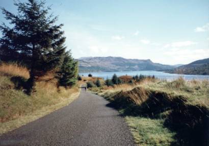
Loch Katrine
Day 8 –Satuday
Callander to Stirling
Callander – Doune – Bridge
of Allan – Stirling (& home!) (Multimap link)
Distance: 24.4 miles,
Climbing: 350 ft, time: 1 h 55 minutes
Out of Callander, follow the
minor road along the River Teith (B8032) to Doune. Turn left over the bridge, turn right into Doune and continue
through the village. After leaving the
village, turn right following signs for Dunblane. Then take another right onto a minor road to Inverardoch Mains
that brings you out in Bridge of Allan.
On entering Stirling, stop at Corrierrie’s café for coffee.
For accommodation in Stirling, there is modern SYHA
hostel and an Independent hostel, in addition to a large number of B&B’s,
to choose from.
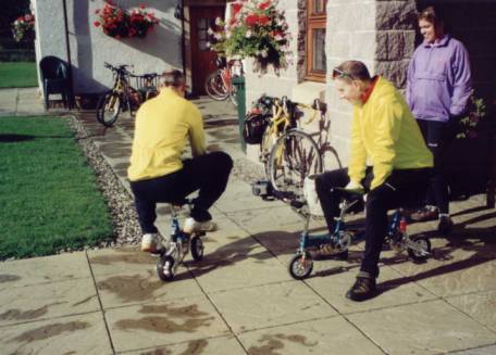
Playing on the monkey bikes at Trossach’s
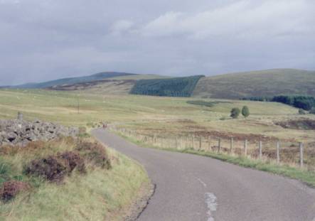
Backpackers
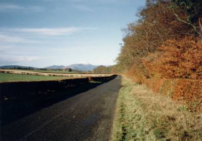
The road from Callander to Doune, looking back to
Callander and Ben Ledi
The Route:
