Crispin's Guide to Stirling Cycling - Round Britain
Summer in the Saddle (A bike ride round
Britain and Ireland)
Crispin Bennett
One afternoon in Wooster, Ohio, while thinking of holidays past
and watching the snow come down, I realized that I knew a foreign country
better than my own. There and then I decided that when I returned home I would
cycle round Britain.
The planning commenced. The bike was upgraded, camping equipment
was bought, and everyone was informed of my intentions. When a friend said that
she had always wanted to visit Ireland, that too was added to the itinerary.
On
2nd April 1995 my father drove me to Tilbury to catch the ferry across the
Thames to Gravesend, and the trip had started. Although I had told everyone
that it would take me five to six months to cycle the necessary 5000-6000
miles, I really had no idea how long I would be gone for, nor how many miles I
would actually cover.
That first afternoon was awful. It was my first attempt at riding
the bike fully loaded and its handling was horrendous: the front wheel had a
mind of its own. In addition, there were more hills in Kent than I had realised
and I was exhausted by the time I found a campsite that first evening, next to
a pub near Canterbury.
Over the next few days I started to develop a routine. No matter
when I awoke I would force myself to lie in my cosy sleeping bag until at least
7.30 am. I would then consume a tin of rice-pudding before packing up the tent
and cycling off in search of more breakfast. With a lot of practise I managed
to go from sleeping to cycling in less than thirty minutes, although my first
few attempts involved a lot of discomfort as my fingers froze in the early
morning frost. Once I had found a shop my handlebar-bag would be home to
sufficient chocolate bars to keep me going until midday. Lunch was consumed
either on a park bench or, if it was really cold, while cycling along. As
evening approached I would start looking for somewhere to camp, and it was then
a simple job to erect the tent, light the stove, and spend the next twelve
hours tucked up in my sleeping bag whilst poring over the map, planning the
next day's route by the light of my Vistalite. Whenever possible I would stay
at a youth hostel that allowed camping, and this would enable me to sit upright
in front of a fire and talk to someone.
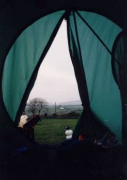
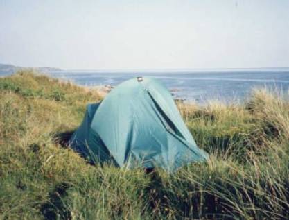
View from the tent
In such a manner, cycling 50-60 miles a
day on quiet roads, I reached Britain's first corner, Dover, on the third day
of the trip. I then turned right and, keeping the sea on my left, headed for
Land's End. The first part of this stretch, until Southampton, was the least
enjoyable part of the tour as it was not always possible to find back roads. I
spent far too many hours with my nerves being racked by juggernauts and other
life-threatening traffic.
As I headed west I started to notice with
increasing concern that the hills were getting bigger and bigger. Even the
gentlest of inclines sent me into a speed-killing 20-inch granny gear as I
spent an eternity climbing each hill before descending in a brake-screeching
rush. As I entered Devon my fitness was improving and the mileage on my
trip-computer was starting to look impressive. Days of the week no longer had
meaning, as all the shops are open on a Sunday in south-coast holiday resorts.
Such ignorance of calendars matters resulted in pitching my tent at a campsite
which had not yet opened for the season. The owner looked most agitated when
she came home later that evening. Then, just a few days later, I turned up at a
youth hostel as the warden was about to celebrate a night off. Oops.
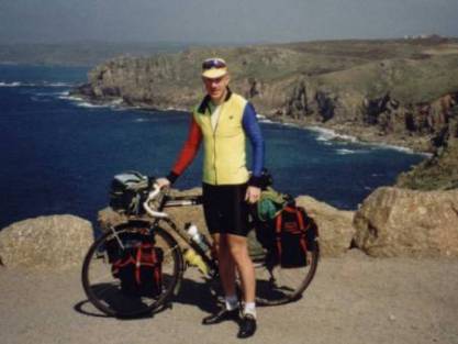
Land’s End
Easter weekend found me in Cornwall as I ticked off Lizard Point
and the commercial nightmare called Land's End. My derailleur pulley wheel
decided to fall off as I approached Newquay, but it was a simple job to walk
back down the road retrieving the wayward bits and then put everything back
together again. On Easter Monday the weather broke and for the first time in
two weeks it rained. And then it rained some more. No need to panic though, as
shopping in Ilfracombe, I bumped into some friends from Hertford and they
offered me accommodation for the night.
After a fantastic initial two weeks of sunshine the weather Gods
had obviously decided to start playing with me. It snowed as I crossed Exmoor,
leaving a coating of ice on my tent the next morning, whilst at Tintern Abbey,
where I camped next to the River Wye, the temperature dropped down to -3oC. Frozen
rain pooled on top of my panniers as I cycled through Port Talbot, and when I
decided that I needed to buy dry gloves the shop-owner would not let me leave
until I had stood in front of the fire for 10 minutes. Thankfully, my Aunt had
a cup of tea waiting for me when I finally reached Mumbles.
After three days of r'n'r and laundry, coupled with a quick tour
of the Gower peninsula, I moved on. Cycling through Pembrokeshire was akin to
being in a war zone with roads closed by artillery firing, and the sound of
tank and small-arms' fire cracking through the silence. As I descended to
Devil's Bridge, near Aberystwyth, a spoke popped in my rear wheel; at least
that explained the creaking noise that had been irritating me for days. Why do
these thing always happen on a Sunday when all the cycle shops are closed?
With a rebuilt wheel I headed north towards Holyhead and edged
around Snowdonia, where the wind mysteriously turns signposts and paints them
out too. I then caught the ferry to Dun Loaghaire and Ireland.
The one thing I had not appreciated about Ireland was how
horrendous the roads are. Between villages the roads are just rough, but in
towns I had to stand on the pedals in order to see out of the potholes. I was
using the widest touring-tyres on the market but these did not even start to
protect my body from the pummeling the roads handed out. No wonder all the
local cars have bits falling off of them.
After allowing my jaw to drop at the beauty of Glendalough in the
Wicklow mountains, I headed south to Kilkenny where the youth hostel is a 14th
century castle. Roads in this area where extremely quiet and on the main roads
I had an entire 'slow lane' to myself. Wandering off into the lanes was always
a step into the cartographic unknown, although I generally had no problems
finding a local to get redirected by. After kissing the Blarney Stone at
Blarney Castle, near Cork, I cycled along the south coast to Bantry, where I
was a day too early for the mussel festival, and then up to the Ring of Kerry, which
greeted me with a mixture of rain, gales and hail to temper the patchwork of
green fields.
And then I found heaven's coast road. At the tip of Dingle
peninsula is Slea Head, Europe's most westerly road. Blasted out of the cliffs
that plunge down to the sea, the road offers ever changing coastal views as it
snakes along.
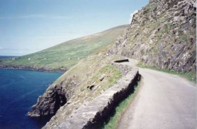
Slea Head
Another road carved out of the rock was
Connor Pass, which reached 1500 ft at its summit, and offered panoramic views back
to Dingle bay where I was later to see Fungi the dolphin swimming. Two days on
I was at the Cliffs of Moher, where I was able to poke my nose over the edge of
a sheer 600ft drop. If I knew anything about botany I would have been amazed at
the alpine plants to be found on the limestone-outcrop called the Burren, but
instead I had to be content with being awestruck at the energy of the music to
be found in Doolin's bars. Cycling along I became intrigued at how the cows got
into the fields: they were surrounded by stone walls on all sides. I soon
discovered that the locals dismantle a wall, persuade the animals to enter the
field, and then rebuild the wall slowly by hand. Such is the pace of life in
this part of the world.
I
continued to head north through Counties Galway, Mayo, and Sligo. The weather
was ever changing from sunshine to rain; no sooner had I taken my waterproofs
then I would need to put them back on again, but the scenery was fantastic. As
mountains plunged down to the lochs, the road would always find a way through
and only the sheep did not seem to be delighted to see me. It was impossible to
get a map out without someone wandering over to check that I was OK, and ask
where I was from and whether it was a good bike? (it used to be !). When I
turned up at a hostel a peat fire would be burning and the kettle would always
be on. I was now in Donegal, and everything just seemed to keep on getting
greener (and wetter too for that matter). The natives just kept on getting
friendlier. Crossing in to Northern Ireland, via a now unmanned army
check-point I visited the Giant's Causeway and the Carrick-a-Rede rope-bridge,
meandered along the Antrim Glens, blew a back tyre, popped another spoke, and
then visited a friend in Belfast. Before I knew it, I was in the chaos called
Dublin and being extremely seasick on the ferry back to Holyhead.
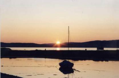
Sunset at Lochranza - 23 June
Back in mainland Britain I got fed up with
coastal traffic and headed inland - most definitely not an easy option as I
pushed my bike up a 1 in 4 hill for over a mile to get to Rowen Youth Hostel.
Coming back down the next day was quite exciting too. In the Peak District I
pedalled into yet another cold northerly wind as I passed Britain's highest
village, and then I battled around Manchester before escaping to the peace and
quiet of the Forest of Bowland. The Lake District was a contrast of deserted
lanes and busy main roads. After a quick detour to see Hadrian's Wall I started
to track westwards again, this time ending up at Minigaff in Dumfries and
Galloway, where I spent two days touring around the southern peninsulas. The
Galloway Moors are known by many as "Highwayman Country", after the
cyclist Davie Bell who knew the roads so well, and I stopped to take in the
view by his memorial at the foot of the Nick o'the Balloch. As I approached Ayr
I was in my old stamping ground, and when I saw the peaks of Arran it was like
greeting an old friend again.
Two ferry journeys later and I was on the Kintyre peninsula, where
I camped on the dunes near Southend, before I set about ticking off a lot of
the fiddlier Islands such as Islay (three distilleries), Jura (three mountains
with a road leading to the distillery), and Colonsay (8 miles of road, no
distillery). On Mull, all I could hear as I lay in my tent was the tapping of
midges on nylon as they tried to get at my blood. I crossed the bleak Morvern
peninsula, followed the Road to the Isles, and then skipped across to Skye and
Raasay, where I was the first person to arrive at the hostel in over a week.
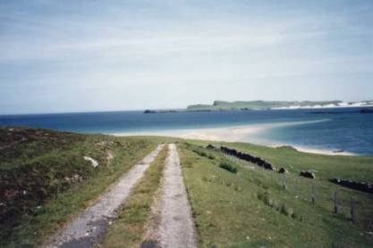
Camped on the
dunes
There is only one real way to get off of
Skye and that is by the ferry at Glenelg; seals swam by, the road was deserted,
and the view from Bealach Ratagan took my breath away even more than the climb
did. As I headed up the west coast of Scotland, the brown squiggly lines on my
map were right on top of one another, and I climbed 14 single-arrow hills in
one 62-mile day as I crawled along between Achmelvich and Durness. I must confess,
however, that I did miss out the six-mile, 2035ft climb of Bealach-nam-Bo to
Applecross: it was raining and I had done it before.
Eventually I reached Cape Wrath, the northwesterly tip of Britain.
The 12 miles of road to Cape Wrath is reached by passenger ferry so there are
no cars on the road, just a couple of minibuses taking tourists to and from the
lighthouse. As the single-track road is built on peat, every time a bus goes
past the road bounces. On the ride back I saw seals basking on a sandbank and,
because the water was so clear, swimming under water. It was here that I met
Simon and his dog, who were walking round Britain. Crazy fools!
The road to
Cape Wrath
Turning right once more, I battled into yet more headwinds. After
leaving Durness I gave up for the day in Tongue when the wind kept blowing my
lunchtime rice-pudding off the spoon. At some points that morning I'd reached
3mph on the flats. Dunnet Head (the most northerly point) and John O'Groats
(the most northeasterly town) were all shrouded in fog. Britain's most
northeasterly point is actually at Duncansby Head. On a previous trip the view
here had been amazing, with cliffs jutting straight towards me and stacks
looming just offshore. Unfortunately, all I could see this time was more fog
and a single nesting puffin. I could still smell the many other sea birds
though.
From John O'Groats, according to my map, it was downhill all the
way. Unfortunately, according to my legs, it was not. As I cycled towards
Helmsdale I spent my second day in a fog-induced sensory deprivation and I was
rapidly running out of ways to keep myself cheerful. Thankfully the next day
was clear, if not dry, and I managed to get the last bed at the 200-bed hostel
at Carbisdale Castle. Dancing the Gay Gordons at that night's ceilidh was the
most exhausting part of the trip.
From Inverness I wandered through Tomintoul and Braemar, taking in
the 2000ft Lecht as a matter of course. I had the pleasure of camping next to
the A9 in Perth, before crossing the Forth road bridge, losing the cycle path,
and having to cycle through Edinburgh in the rush hour.
Entering Berwick-on-Tweed I saw someone waving at me. It was
Graham, with whom I had spent four days cycling on Islay, and all he had done
was walk into town to buy a paper. It's a small world. I found more hills in
the Pennines, and even more in the Yorkshire Dales and Moors. It was at this
point that Britain's long-hot-summer finally noticed me and at long last I
could stow away my rain cape. There is always a downside, however, and coming
through the Yorkshire Wold I found myself covered completely in thunder flies;
they were in my eyes, up my nose, everywhere. Yuk.
From here I was into flatness. After visiting the National Cycle
Museum in Lincoln and having fish'n'chips for supper (it had suddenly occurred
to me that I had not had any chips in three whole months), I crossed the
billiard table they call the fens. Nothing but fields of corn as far as the eye
could see. After what seemed an eternity I was at Lowestoft, home to the
easternmost bit of Britain. Tracking down this geographic curiosity was not
difficult, it is immediately behind the Bird's Eye frozen-fish factory and next
to the Caravan & Camping Club's Stulag-17. After the compulsory photo' stop
all I had to do then was head home, so I did.
Four months after setting out, and having cycled 6168 miles, I was
back home in Hertford. I had cycled round Britain and Ireland. I had started to
see my own country.
Crispin Bennett (c) 2001
Crispin's Guide to Stirling Cycling - Round Britain